Scapegoat Plateau Backpack
July 23, 2018Audrey and Aaron spend five days hiking a 50 mile loop in the Scapegoat Wilderness and traverse the Scapegoat Plateau
For our 3rd annual father-daughter backpack Audrey and I headed to the Scapegoat Wilderness with food for five days and a plans to hike cross-country across the Scapegoat Plateau and hopefully summit Scapegoat Mountain. Much of the plateau is guarded by dramatic shear cliffs similar in character to the Chinese Wall in the Bob Marshall Wilderness to the north. The typical route onto the Scapegoat Plateau is via a climbers trail at the head of the Green Fork valley that had reportedly been washed out a couple years ago and was passable but dangerous. I had mapped a route using an old trail to Cigarette Rock that would provide easier access to the plateau and give us more time in the high country. However, to complete our planned loop we would have to descend into the Green Fork valley on that dangerous climbers trail.
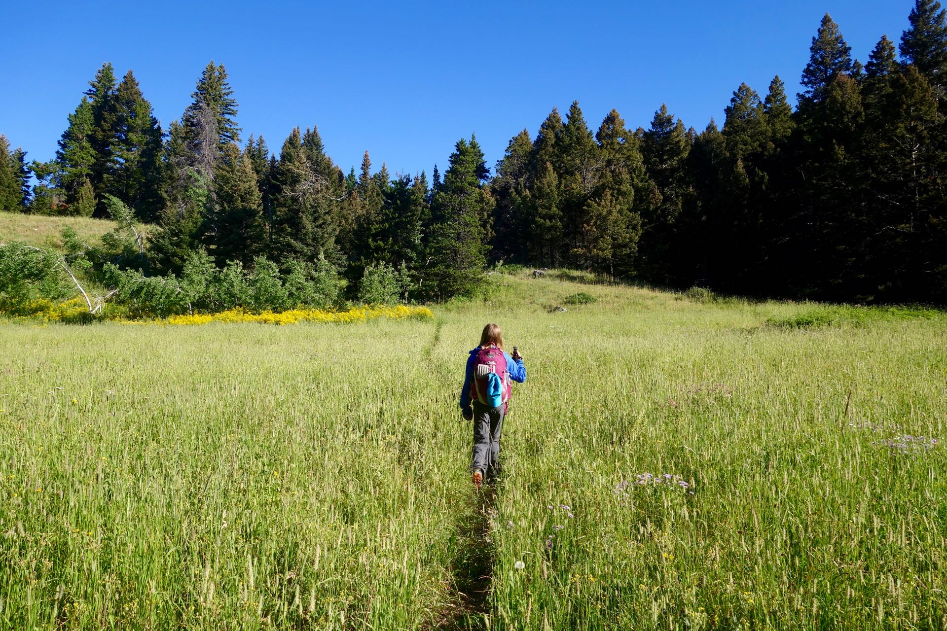
We started from the Crown Mountain trailhead and made quick progress on a good trail up to the pass. On the far side of the pass we soon entered an expansive burn area that we walked through for the rest of the day and through the next morning. The trail through the burn was less traveled and disappeared in places but was always easy to spot again a short ways down the valley. The burned forest offered little relief from the hot sun. We gave up on finding a shady spot for a break and settled into the shadow of the biggest tree around. But we had to scoot over every few minutes as the tree’s shadow migrated like a giant sundial.
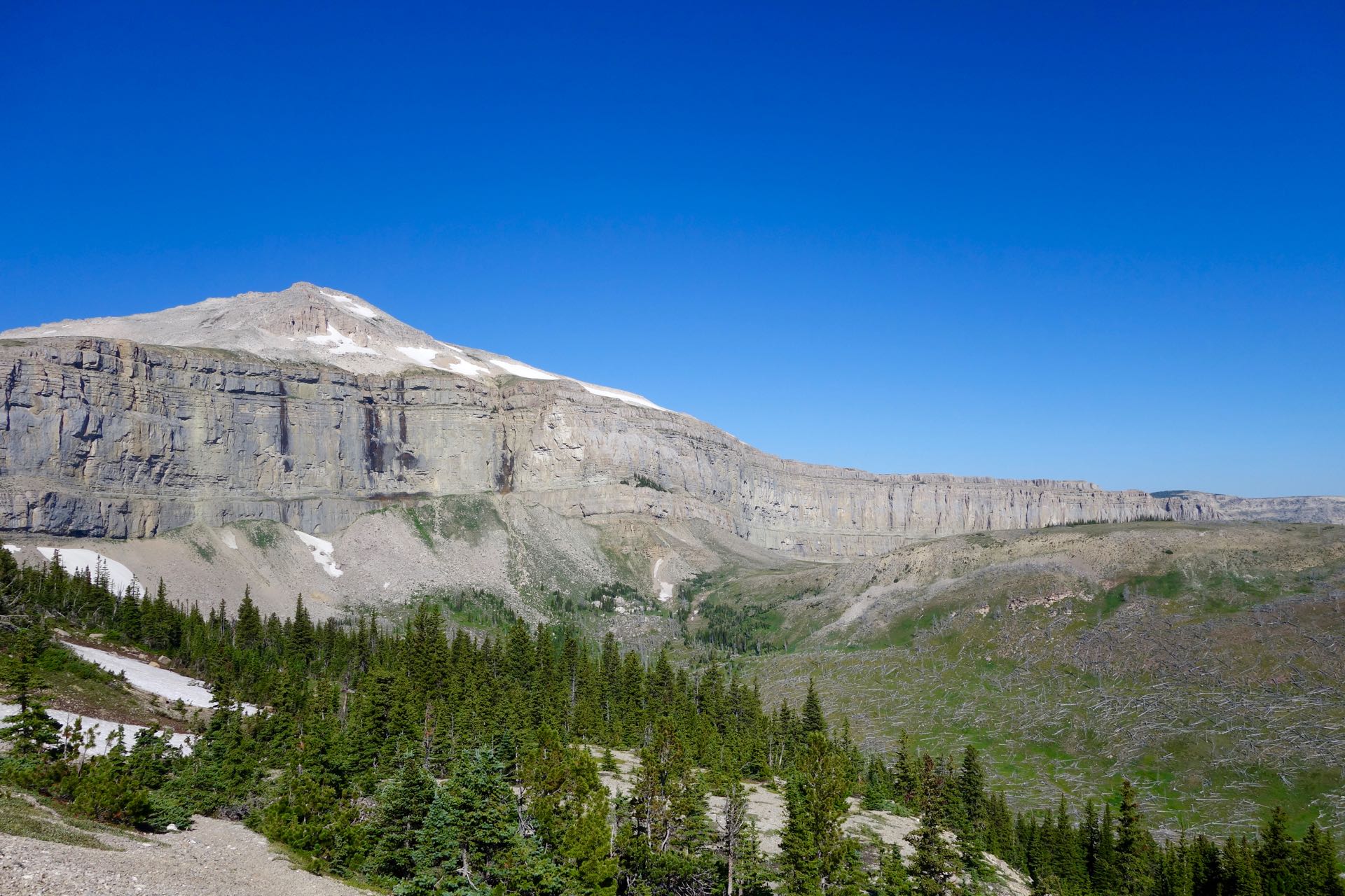
We made camp along Straight Creek near the junction with the Cigarette Rock trail having not seen another person for the entire day. The sun was slow to reach the damp and chilly creek bottom in the morning and it took us a while to get moving. However, I could already see the sun lighting up our first objective of the day, Cigarette Rock, far above. Hopefully, this oddly named point would give us easy access to the Scapegoat Plateau. The Cigarette Rock trail was impossible to locate in the creek bottom so I used a GPS track to guide our way up the gentle slope and soon we spotted the trail. It was quickly apparent from the many downed trees that the trail gets little use. Initially, Audrey was annoyed by the log hopping but she soon joined me in clearing the smaller branches and trees that were moveable. The burned deadfall wood was surprisingly light and made us feel like giants as we pitched trees down the hill. The trail disappeared again as we approached open slopes below Cigarette Rock and I thought we would have to find out own route the rest of the way up. Surprisingly, a good track reappeared in the trees on the upper slopes and we followed it right up to the ridge and our first view of the Scapegoat Plateau with the dramatic cliffs of Flint Mountain visible in the distance.
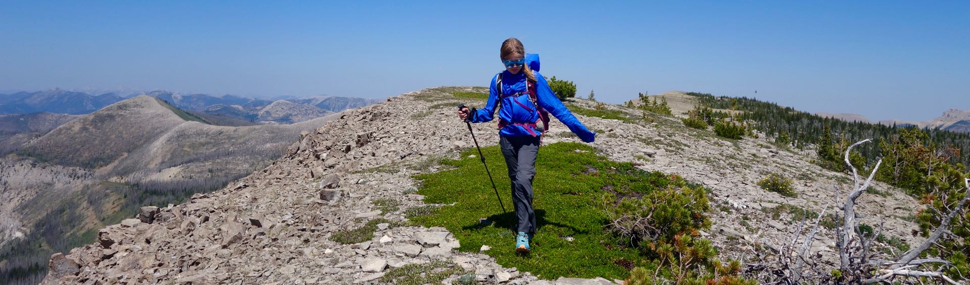
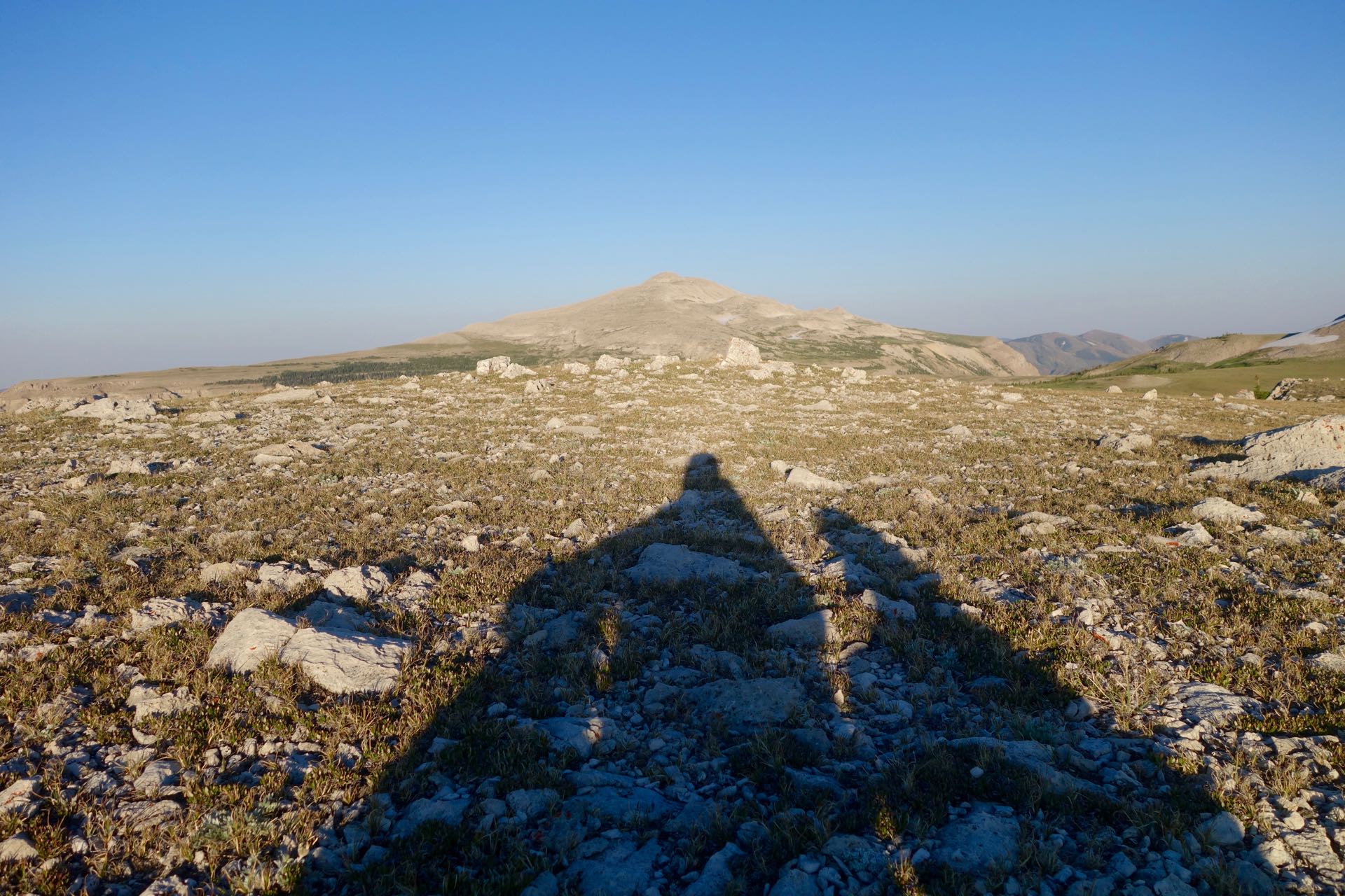
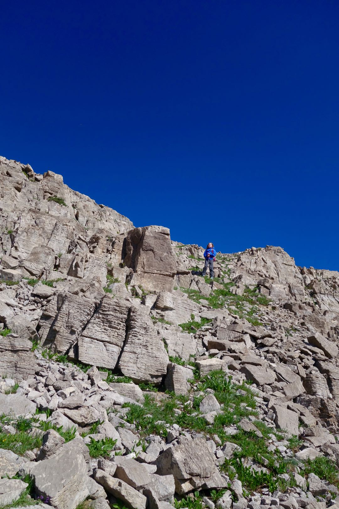
An established path continued straight ahead taking the easiest route to the plateau highlands. We left the user path and climbed the gentle slope to the top of Cigarette Rock to take in the views. I had mapped out a route that traversed the ridge southwest of Cigarette Rock and then dropped down onto the Plateau. Audrey was willing to try it so we descended to a small muddy pond and then climbed steeply onto the ridge. The ridge walking was sublime with excellent views of the plateau, cliffs, Scapegoat Mountain, and distant peaks in every direction. It was windy, but sunny and warm. My biggest concern about the ridge was descending the steep slopes at the end down to the plateau. As we rounded the final high point I was quite relieved to see that it was steep but walkable. We descended carefully and soon were walking on a flat surface of limestone peppered with chunks of rock left behind from layers eroded away long ago. Audrey commented that the expansive rock surface reminded her of Moab. It would be a fun place to ride a bike.
To spend a night and the next day on the plateau we needed to find water. There were snowfields around but we had already encountered places where the snow melted and immediately seeped right into the porous ground. We soon found a large snowfield with a modest stream of water than ran a short ways and then dropped into a crack in the limestone and disappeared. We filled our bottles and then walked traversed along the base of the hill finding many more locations where water was running. But each time when the stream reached the rock it soon dropped down some hole or crack and disappeared.
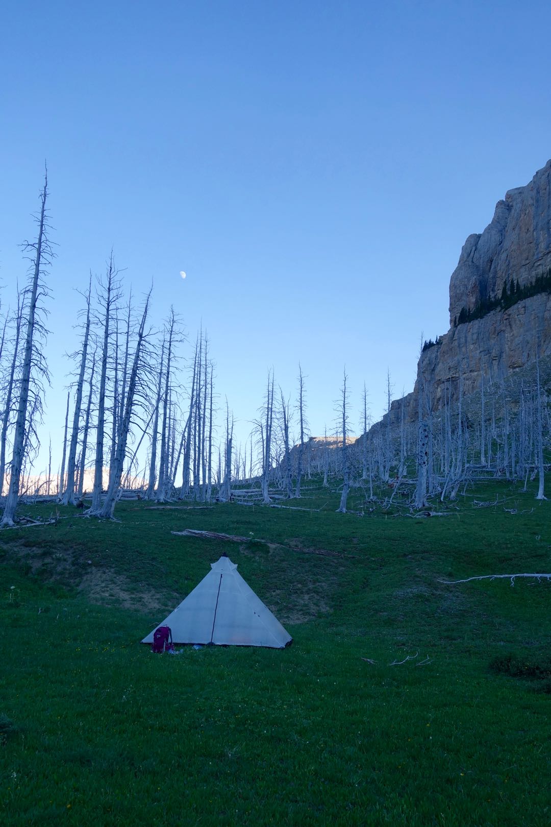
We setup our tent in a beautiful meadow surrounded on three sides by small trees to help protect us from the wind. We found a nice place to relax and have dinner overlooking the Green Fork Canyon cliffs and Scapegoat Mountain. Audrey volunteered to help me to hang the food that night. She tried a couple times underhand (my recommended approach) then tried overhand and threw it over the branch on her first toss. With our camp camp chores complete and some light still in the sky I convinced Audrey to walk a little ways up to a ridge behind our tent to watch the sunset. She kindly agreed despite having already spent a lot of time on her feet that day. We walked trough meadows, found an old user trail, danced over rocks to avoid muddy ground, and walked up a small snowfield on our way to the ridge. It was quite windy but the we caught a last bit of sunshine before it dropped behind Flint Mountain and got to gaze at the sun painted slopes of Scapegoat Peak.
With a clear view to the east from our tent the sun rose early and made for an enjoyable breakfast in the meadow. Audrey took to packing her own backpack this year. A task that I had mostly done in years past. On the first morning I helped her a little. But by the second morning she had it down. She started pitching in on other tasks too, like setting up the tent, which made us much more efficient at braking camp each morning and setting up each night.
We walked a short ways to the nearest disappearing stream and loaded up our water bottles for the day. I pulled out a headlamp and we each took a turn sticking our head down the hole to see where the water went. The stream ran a short ways along a rock surface and then disappeared down a crack. While Audrey was taking her turn I spotted some movement on the rocky slope above us and looked up to see a bull elk descending from the peak just above. He was quickly followed by another bull and they both disappeared into the trees likely heading to one of the other streams for a morning drink.
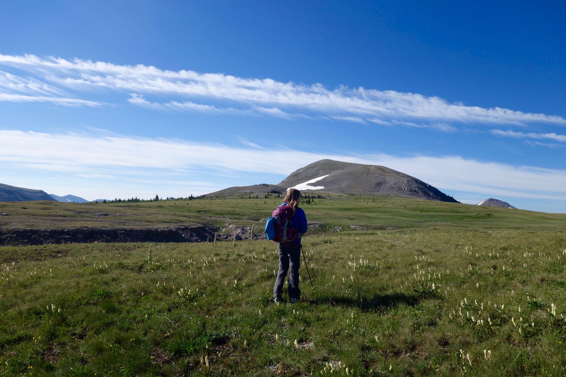
The walk across the plateau to the gentle slopes of Scapegoat Mountain was a highlight of the trip. We strolled through fields of grass and small flowers occasionally passing a sinkhole with a remnant from the winter snowpack hiding in the shadows at the bottom. We took a route aiming for a gentle ridge on the western flank of Scapegoat Mountain but found ourselves at the top of some small broken cliff bands that could have easily been avoided if we had stayed more to the north. Instead of backtracking we managed to pick our way down without much difficulty and then proceeded to climb onto the western ridge of Scapegoat Mountain. On the way up to the ridge a bird surprised me flying up from right near my feet. I paused and looked down to see where it came from and spotted a small hole in the ground containing a tiny nest and a clutch of eggs. I pointed it out to Audrey and we moved on quickly to allow the bird to return to her eggs.
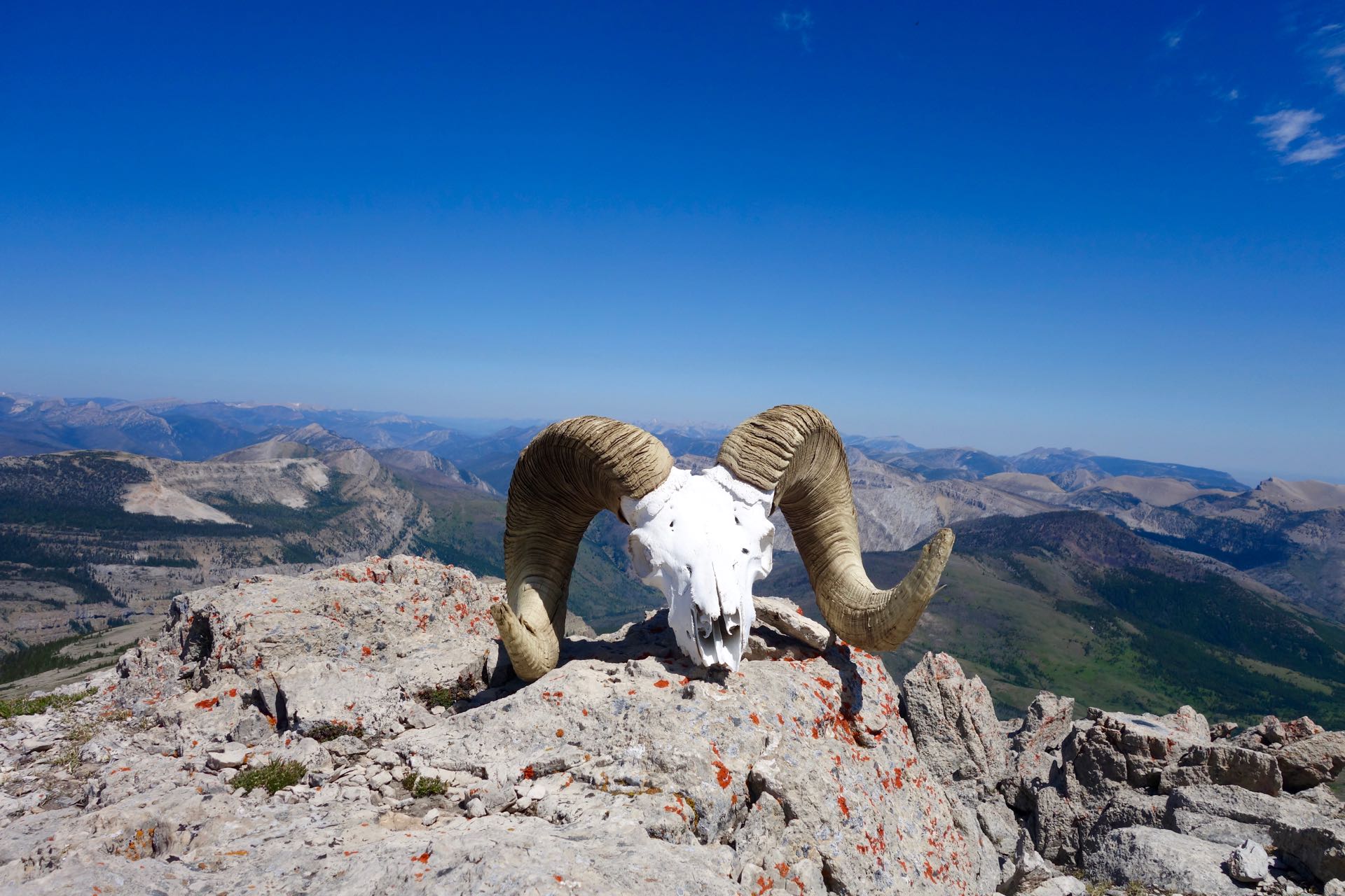
The approach to Scapegoat Mountain is a long gentle walk up from the west with a small scree ramp providing easy access to the summit. I was quite surprised when my head crested the top to see a bleached big horn sheep skull with a complete pair of horns “staring” right at me. Someone had placed it well. From the top mountains receded into the horizon in every direction except to the east where beyond ridges and hills the plains of the Rocky Mountain Front were visible in the distance. Far below the cliffs I could pick out the trail that we would walk along the next day.
Audrey was justifiably concerned about our planned descent route down into the Green Fork valley. I knew there was an established “climbers” trail that traversed above a section of cliffs to reach a more gentle slope that allowed for a safe descent to the valley floor. However, I had read a report from a couple years earlier that described a section of the traverse that had eroded out creating a treacherous no-fall zone. I had told Audrey that if it looked too dangerous we would have to backtrack and return down the Cigarette Mountain trail.
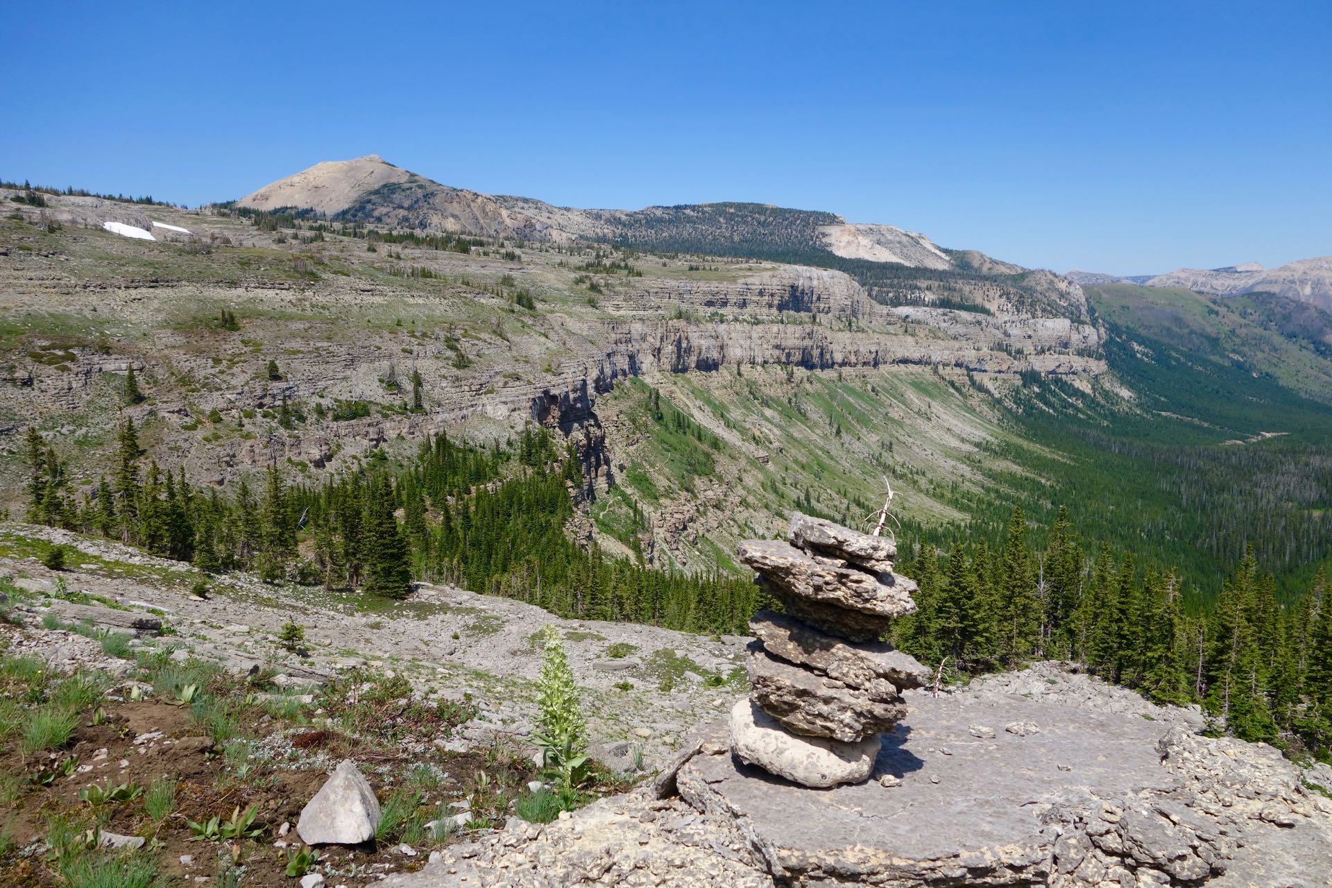
As we descended toward the cliffs we spotted cairns confirming our course and we soon spotted the dirt path on the valley wall. Thankfully, when we reached the high traverse the trail was well worn-in from use over the last couple of years. It was not dangerous, but certainly kept us focused. In places the trail crossed a steep earthen slope that funneled down to a drop over the cliff below. A stumble here could end badly. We proceeded carefully and were soon dropped down a steep slope, crossed a creek, and rejoined an official trail. We made good time walking down the Green Fork valley and took a short side trip to swim in a small unnamed lake. Waterfalls were emanating from the cliff walls in the distance making a dramatic demonstration of what happens to the water that disappears into the ground on the plateau.
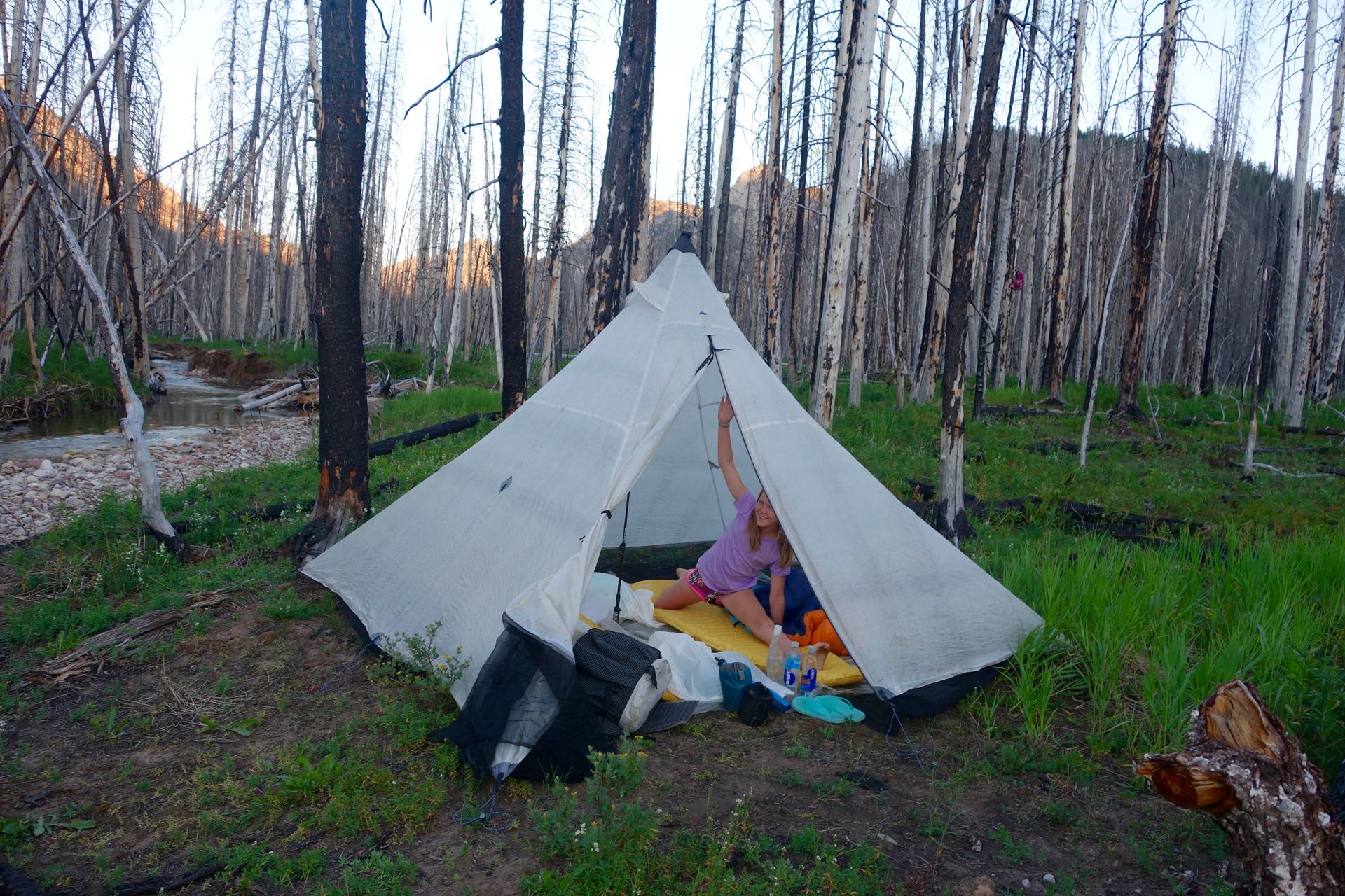
From the lake we climbed up a trail over a ridge to reach Halfmoon Basin. After a long day on our feet the climb up to the ridge seemed to drag on. But we were both in good spirits and were rewarded with views of the vertical cliff walls as we descended down to Halfmoon Creek. This is a popular area and I thought we would encounter our first people of the trip but was quite surprised to find the established camp sites all empty. We left the tail and picked out a quiet place by the creek to take a break and made dinner before deciding if we would camp or continue farther up the trail. We took our time eating, re-filled our water, and then decided to walk a bit more. With dinner done and full water bottles we were free to camp anywhere that looked like a nice spot. We left the creek and entered a burned area no standing trees allowing for great views of the Halfmoon Park cliffs with the sun descending behind them. Just short of the pass we spotted an idyllic site in a small meadow just below the cliffs. The meadow was surrounded by burned snags but with our tent in the middle of the little clearing it was unlikely that any of them would reach us if they fell. It was a warm and breezy night and we both slept well.
Each morning we seemed to get more efficient with packing up and getting started. On our fourth morning we decided to start walking and take a break for breakfast somewhere down the trail. From the pass right above our campsite we had excellent views of the cliff walls extending in both directions. We passed a junction for the Dearborn river trail and found a pleasant rock in the sunshine to have breakfast and coffee. We took our time but when we started packing up to go Audrey gave me a hard time for taking so long with my backpack. I finally pulled it together and then quickly jumped up to strap my pack on as fast as could. As soon as I was finished I said to Audrey, “WHAT IS TAKING YOU SO LONG?”, and we both got a good laugh out of it.
As the trail turned toward the north to traverse around a ridge we had excellent views of the plateau cliffs capped by Scapegoat Mountain. We stopped several times to take pictures and it seemed like each spot was better than the last. On the far side of the ridge we stopped to take a short break and consult the map and discovered the junction with the Cave Creek trail was near. We heard something, glanced up, and spotted a solo backpacker heading away from us down he adjoining trail a short distance away. This was the first person we had seen since we left the car and his back was to us so I doubt he had any idea we were there.
The area around the Cave Creek trail had the best wildflowers we had seen on the trip. We stopped to take pictures and Audrey tried to stalk the butterflies to capture close-up shots. She was much more patient and stealthy than I was. We descended steadily with good views of Dearborn River valley below us and an unnamed red rock peak with green forested slopes across the valley.
Early in the afternoon we reached the Dearborn River and followed the valley for three miles to the Welcome Creek ranger station. I really enjoy walking through the protected river bottoms in the Bob Marshall Wilderness Complex. Most wilderness areas are limited to the mountain peaks but the valley bottoms are developed. While walking along rivers in the Bob I feel like I’ve stepped back in time and imagine what it was like to stroll on the banks of the Clark Fork River before the city of Missoula grew up around it. As we made our way down the river corridor Audrey spotted the largest patch of ripe wild strawberries I have ever seen. She dropped to her knees and crawled along eating every bright red berry she could find. Other than color wild strawberries bear little resemblance the gargantuan supermarket version. But what they lack in size they make up for in taste. When Audrey had her fill we moved along and soon reached the Welcome Creek ranger station and left the Dearborn River trail to begin a short ascent to Welcome Pass.
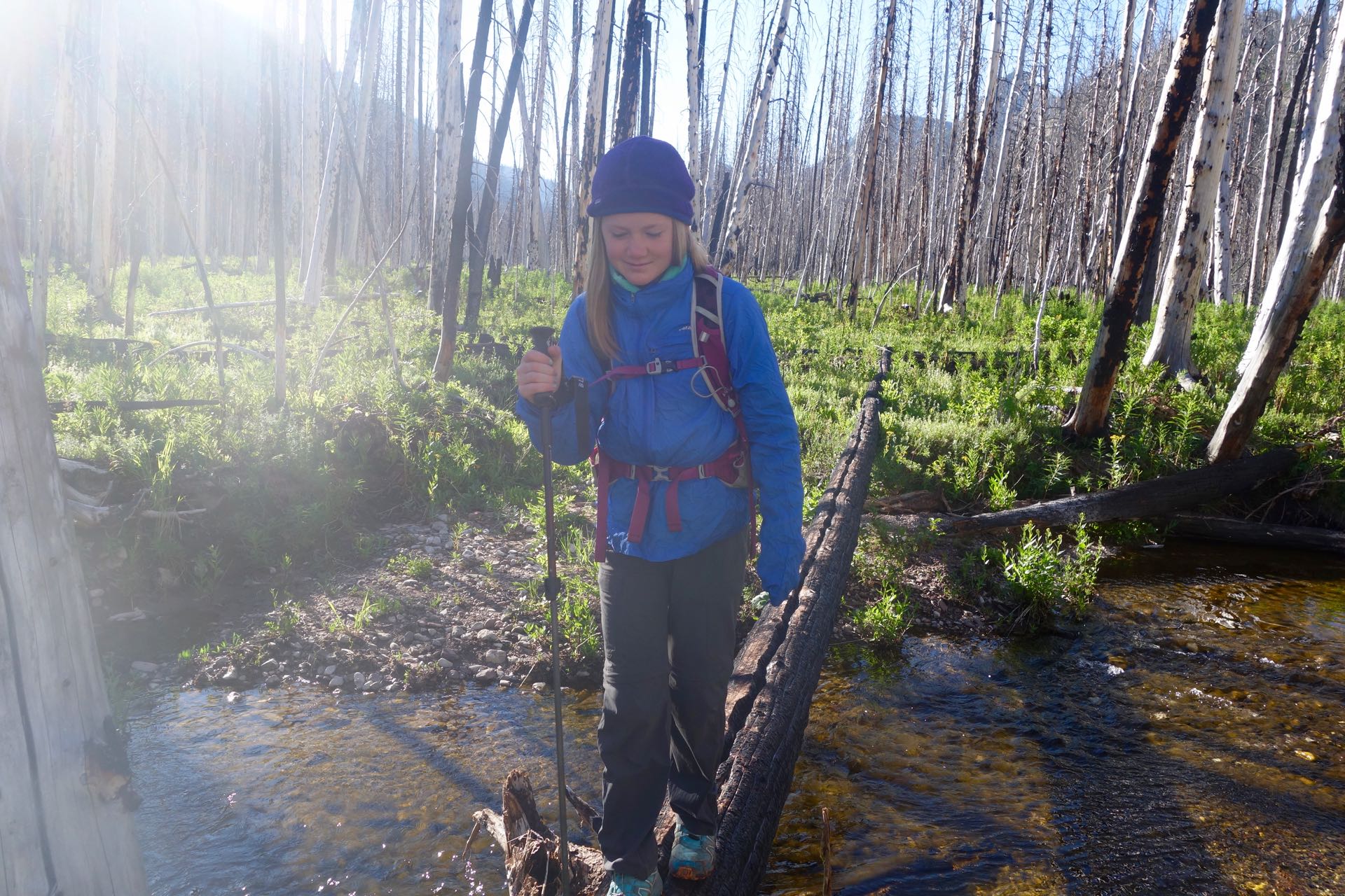
Welcome Pass came quickly and we left the Scapegoat Wilderness and headed down the Jakie Creek trail. The trail is this section was deeply eroded and the huge ruts had been filled in with cut-up deadfall trees. A new trail was forming next to the ruts but it was awkward and difficult to follow at times. The trail passed through a boggy area where all the trees surrounding the water were dead and brow and the trail ahead was covered with thick mud. It was clear that recently the water in the small pond had been much higher and the sumbmegred trees had died. The trail must have been under several feet of water.
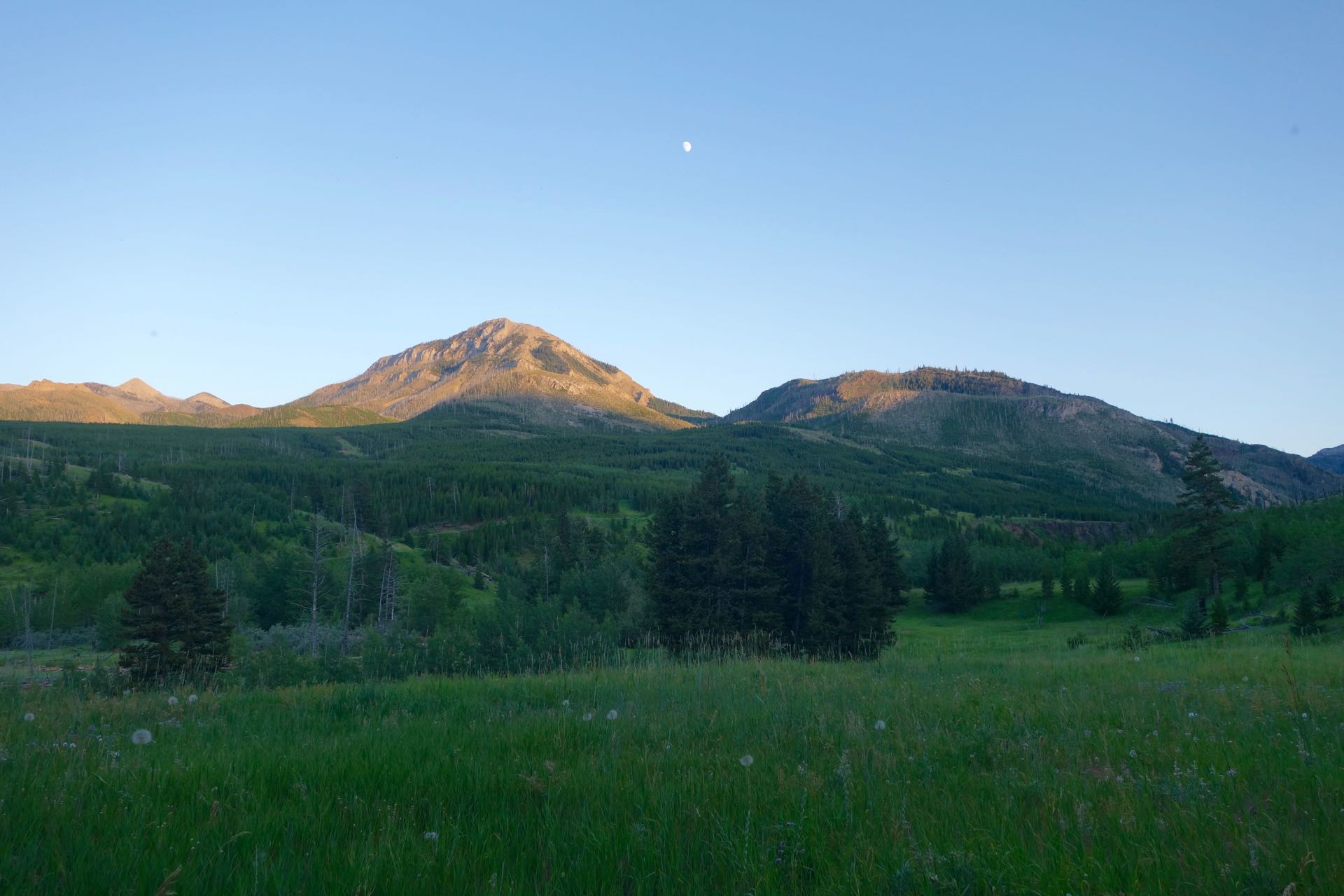
After a long descent we took a break at a crossing of Jakie Creek and decided to go ahead and have dinner. We had been on our feet a long time and it felt good to sit by the cool water. We saved our cookies for later and walked down the trail looking for a place to spend our final night. We followed Smith Creek staying high above the water as the creek flowed through a beautiful canyon. Our search for a campsite became more urgent as the evening waned. We scoped out a couple of spots, including one with a great view looking back up the canyon at a waterfall, but the ground cover vegetation was woody and interspersed with many small prickers. We continued on down the trail and crossed a section of private land and based on that I thought I had us located on the map. However, when we spotted a sign for the Ford Creek trail I realized we had gone further than I thought. We had reached the point where we would leave the creek and begin a climb heading back to the Benchmark road to close the loop. We located a great camping spot on a bluff above the creek and quickly setup our tent then took a break sitting in the grass eating cookies and enjoying the moonrise and alpenglow on the peaks above the green valley. Sleep came easy and soon the sun was returning and we started our last day.
We both woke early ready to get on the trail and complete our five day loop. Just before we started walking I glanced across the valley and spotted a group of eight backpackers hiking along an old road bench. They were pretty far away and I doubt that they saw us. We shouldered our packs and walked up through open forests and wide grassy meadows dotted with wildflowers. As we gained elevation there were some views of Crown Mountain, nothing like the expansive views from our days up on the plateau. But the pleasant walking and warm sunshine made for an enjoyable morning. Soon we reached the low pass and started an efficient descent to the Double Falls campground. When we reached the campground there was no bridge over the creek and we had to wade through the water one last time.
Surprisingly, the Double Falls campground was empty. I could hear water rushing through the trees and we took a slight diversion to check out the falls before heading up to the road to walk back to our car. Double Falls was bigger than I expected and did indeed consist of two stair step cascades living up to its name. Neither of us were looking forward to the final mile on the dusty Benchmark road. Audrey had saved two precious energy chews for the final mile. One for each of us. We decided to each put one in our mouth and not chew it until we reached the car. It takes a bit of concentration to keep yourself from automatically chewing and that slight distraction coupled with the challenged of finishing before it dissolved helped speed us along the road. Soon we reached the car, took off our packs, and broke into the can of Pringles and package of Oreos we had stashed.
Audrey and I had an amazing trip and wonderful time together. Audrey has come a long ways since we started doing these trips two years ago. I’m already thinking about ideas for next summer!